Antarctica
Photos
69 Photos
Per Page:
Filter Categories
All
Filters
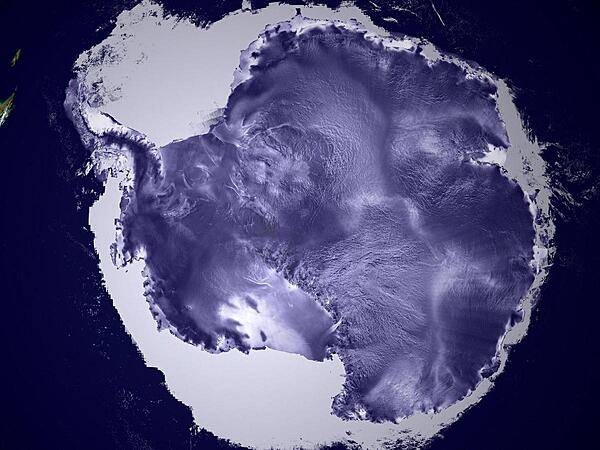
An ICESat image reveals the textured surfaces of Antarctic ice sheets in amazing detail. The high flat area in the center of the continent is called the East Antarctic Plateau; the white area surrounding the continent is sea ice. Image completed 23 May 2003, courtesy of NASA/Goddard Space Flight Center Scientific Visualization Studio, Canadian Space Agency, RADARSAT International Inc.
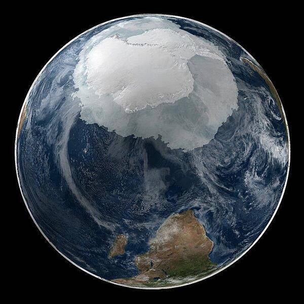
A global view of the Antarctic on 21 September 2005. This image presents the entire Antarctic region, most of the Southern Ocean, large portions of the southern Atlantic and Pacific Oceans, as well as the island of Madagascar and southern Africa. Image courtesy of NASA.
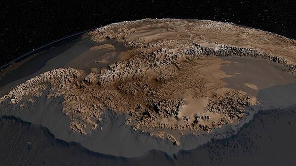
The topography of the bedrock under the Antarctic ice sheet is critical to understanding the dynamic motion of the ice sheet, its thickness, and its influence on the surrounding ocean and global climate. In 2013, the British Antarctic Survey released an updated map of the bed under the Antarctic Ice Sheet and the seabed extending out on to the continental shelf. Called BEDMAP2, it incorporated 25 million measurements taken over the previous two decades from the ground, air, and space. This image shows part of the new BEDMAP2 dataset, which presents the Antarctic surface in unprecedented detail. This view from the west shows the Antarctic Peninsula on the left, Ellsworth Land and Marie Byrd Land in the foreground, with the Transantarctic mountains behind. Image courtesy of NASA.
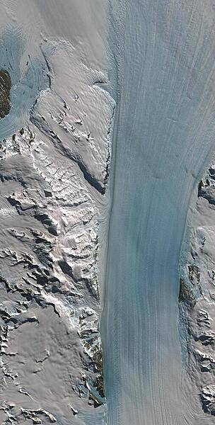
Truly a river of ice, Antarctica's relatively fast-moving Byrd Glacier courses through the Transantarctic Mountains at a rate of 0.8 km (0.5 mi) per year. More than 180 km (112 mi) long, the glacier flows down from the polar plateau (left) to the Ross Ice Shelf (right) in this false-color satellite image. Long, sweeping flow lines are crossed in places by much shorter lines, which are deep cracks in the ice called crevasses. The conspicuous red patches indicate areas of exposed rock. The glacier was named for Rear Admiral Byrd, US Navy, who was an Antarctic explorer. Image courtesy of USGS.
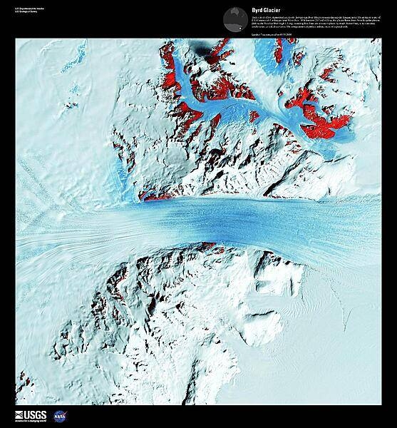
Byrd Glacier is a major glacier in Antarctica; it drains an extensive area of the polar plateau and flows eastward between the Britannia Range and the Churchill Mountains to discharge into the Ross Ice Shelf. This satellite image is courtesy of NASA.
A natural-color image displays McMurdo Station, the largest research base in Antarctica, as well as the surrounding region. Ross Island is roughly 72 km (45 mi) across at its widest point. Part of the McMurdo Dry Valleys may be seen along the right edge. Photo courtesy of NASA.

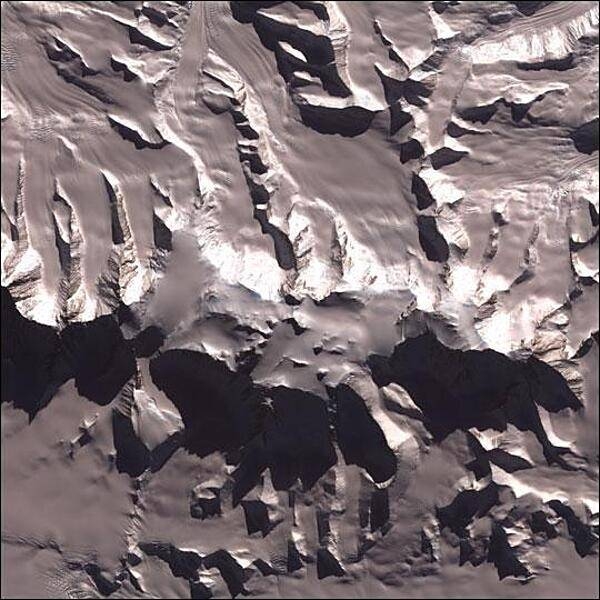
The McMurdo Dry Valleys are a row of valleys west of McMurdo Sound. They are so named because of their extremely low humidity and lack of snow and ice cover. At 4,800 square km (1,900 sq mi), the valleys form the largest ice-free region in Antarctica. This satellite image is courtesy of NASA.

Vinson Massif is the tallest mountain in Antarctica. Its peak reaches 4,897 m (16,067 ft), though the mountain itself is a large raised feature around 21 km (13 mi) long and 13 km (8 mi) wide, dominating the Sentinel Range of the Ellesworth Mountains in which it is located. Image courtesy of NASA.
NASA's DC-8 flying laboratory passes Antarctica's tallest peak, Vinson Massif, on 22 October 2012, during a flight over the continent to measure changes in the massive ice sheet and sea ice. The flight was part of NASA's Operation IceBridge, a multi-year airborne campaign to monitor changes in Earth's polar ice caps in both the Antarctic and Arctic. Vinson Massif is located in the Sentinel Range of the Ellsworth Mountains in Antarctica. Photo courtesy of NASA/Michael Studinger.

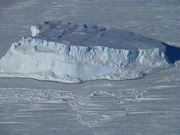
An iceberg trapped in sea ice in the Amundsen Sea, as seen from NASA's IceBridge DC-8 during a mission on 27 October 2012. Credit: NASA/Maria-Jose Vinas.
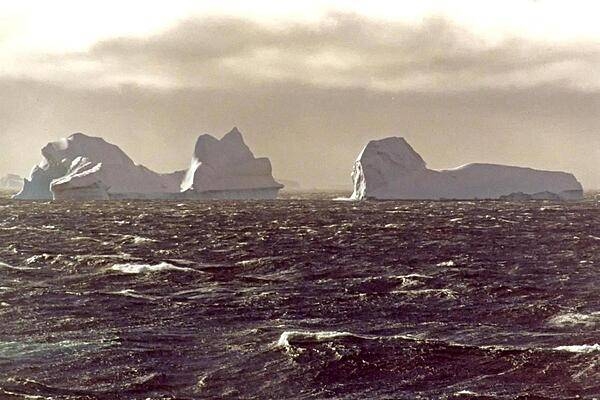
Looming icebergs cruise through rough, windswept seas. The icebergs (large pieces of fresh water ice) broke free from a snow-formed glacier or from the ice shelf that covers much of the continent.
On shore, passengers and crew wear bright colors to avoid getting lost on the ice. The flag marks the landing spot for the Zodiacs (inflatable boats used for transport from the cruise ship).

Page 01 of 06