Go to CIA.gov
World Factbook GlyphWFB (2022)The World Factbook (2022 Archive)
  • Countries
  • Maps
  • References
  • About
Gaza Strip

Photos

1 Photos
Filter Categories
All
Filters
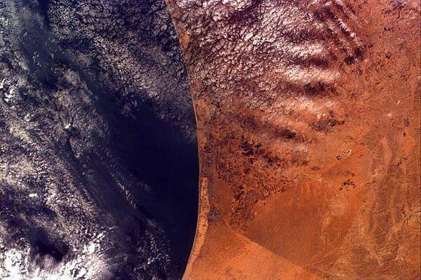
This image covers an area roughly 100x150 km; due to shuttle orientation, north is located at approximately eleven o'clock in this image. Shown are the Gaza Strip (roughly the center third of the coastal strip) and the Mediterranean Sea. The straight-line Egypt-Israel border is apparent in the lower center because of a difference in vegetation patterns, the Egyptian side (south) being less vegetated perhaps due to heavy use of the land for grazing. Photo courtesy of NASA.
Usage

Factbook images and photos — obtained from a variety of sources — are in the public domain and are copyright free.

View Copyright Notice
Agency
  • About CIA
  • Organization
  • Director of the CIA
  • CIA Museum
  • News & Stories
Careers
  • Working at CIA
  • How We Hire
  • Student Programs
  • Browse CIA Jobs
  • My Application
Resources
  • Freedom of Information Act (FOIA)
  • Center for the Study of Intelligence (CSI)
  • The World Factbook
  • Spy Kids
  • Accommodations
Connect with CIA
InstagramFacebookTwitterLinkedInYouTubeFlickr
Search CIA.govSite PoliciesPrivacyNo FEAR ActECA NoticeInspector GeneralUSA.govSitemap