Go to CIA.gov
World Factbook GlyphWFB (2022)The World Factbook (2022 Archive)
  • Countries
  • Maps
  • References
  • About
Montserrat

Photos

4 Photos
Filter Categories
All
Filters
A view of Puerto Rico (upper left) and the isles of the Lesser Antilles. The Soufriere Hills Volcano on the island of Montserrat began emitting steam and ash on 9 February 2006. Low-level activity continued for several days. The volcano produced another plume on 20 March 2006, which is captured on this image. The volcano's pale beige ash plume blows westward over the Caribbean Sea. The red outline shows where the satellite detected a thermal anomaly, an area where the ground surface was significantly hotter than its surroundings. Image courtesy of NASA.
The Soufriere Hills Volcano on the island of Montserrat produced a plume of volcanic ash and/or steam on 1 October 2006, part of a continuing pattern of intermittent eruptions. In this image, the island of Montserrat shows an area outlined in red - the thermal hotspot. The plume of volcanic ash blows westward over the Caribbean Sea, gradually dissipating as it moves away. No recorded eruptions of the volcano occurred before 1995, but since then, volcanic ash emissions have posed recurring health hazards for Montserrat's residents. Photo courtesy of NASA.
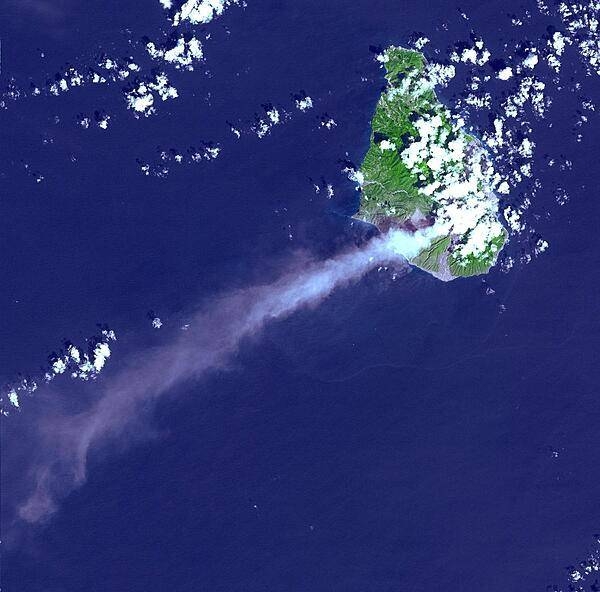
Eruptive activity of the Soufriere Hills Volcano on Montserrat is evidenced by an extensive smoke and ash plume streaming towards the west-southwest (image taken 29 October 2002). Significant eruptive activity began in 1995, forcing the authorities to evacuate about two-thirds of the island's original population of 12,000, and to close off the southern portion of the island. Image courtesy of NASA.
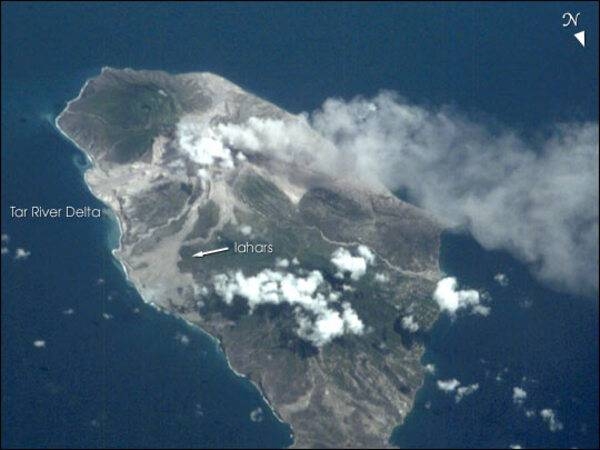
Monserrat's frequent cloud cover can make getting remote sensing images difficult. This view from the International Space Station taken 9 July 2001 recorded a vigorous steam plume emanating from the summit of Soufriere Hills. The image also reveals the extensive volcanic mud flows (lahars) and new deltas built out from the coast from the large amounts of volcanic debris delivered downstream by the rivers draining the mountain. As a small island (only 13 x 8 km), all of Montserrat was impacted by the eruptions. Image courtesy of NASA.
Usage

Factbook images and photos — obtained from a variety of sources — are in the public domain and are copyright free.

View Copyright Notice
Agency
  • About CIA
  • Organization
  • Director of the CIA
  • CIA Museum
  • News & Stories
Careers
  • Working at CIA
  • How We Hire
  • Student Programs
  • Browse CIA Jobs
  • My Application
Resources
  • Freedom of Information Act (FOIA)
  • Center for the Study of Intelligence (CSI)
  • The World Factbook
  • Spy Kids
  • Accommodations
Connect with CIA
InstagramFacebookTwitterLinkedInYouTubeFlickr
Search CIA.govSite PoliciesPrivacyNo FEAR ActECA NoticeInspector GeneralUSA.govSitemap